When people get lost in the forests, search and rescue professionals useInspection Drones
The new system uses an AI application toprocessing multiple images of a specific area. Comparison and processing of data from different cameras allows several thermal imagers to work as one large telescope. After processing the AI images, the final terrain images have a higher depth of field. But the footage shows how the tops of the trees seemed blurry, and the outlines of people on the ground were more recognizable. To train the AI system, the researchers had to create their own image database. They used drones to photograph volunteers on the ground in a variety of positions.
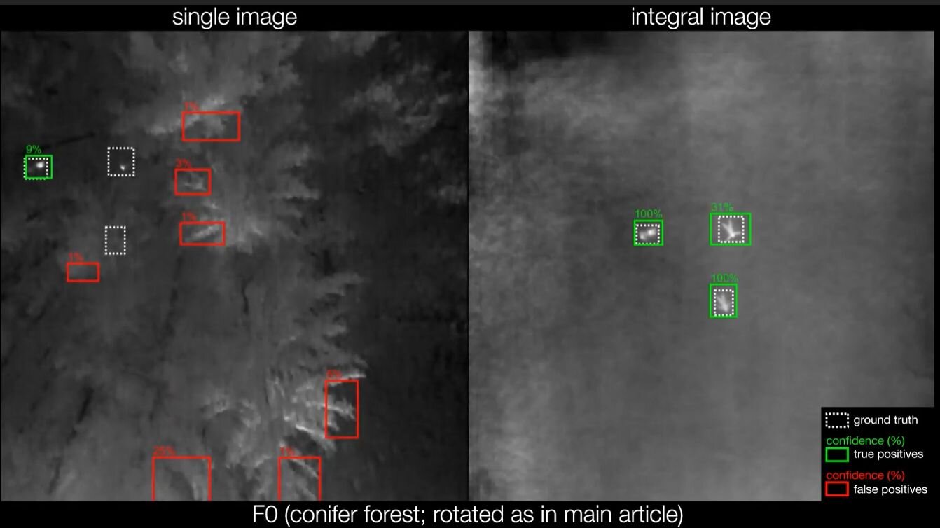
System testing has shown - its accuracyis up to 95% compared to 25% of traditional thermal imaging. The system is ready for use by search and rescue teams, and can also be used by law enforcement, military or wildlife conservation groups, the scientists conclude.
Read also
Found the alleged kingdom of the disappeared Hittites. What have archaeologists found?
The Doomsday glacier turned out to be more dangerous than scientists thought. We tell the main thing
Voluntary death. We tell how the euthanasia procedure works around the world