The results show that satellite-estimated whale population densities were about a third of those
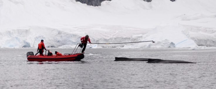 Researchers at the University of California atSanta Cruz places a tag on humpback whales off the western Antarctic Peninsula to record movement and detect dives. The studies were carried out in accordance with NMFS Permit 23095, ACA Permit 2015-014 and IACUC Friea1706. Credit: British Antarctic Survey.
The study was conducted at the Antarcticthe peninsula, a prime summer forage for many species of baleen whales. Satellite images of the Gerlache Strait area, covering ~ 1000 km², were acquired over a two-day period and compared with the annual Brazilian Antarctic Program survey of sea whales, which is being conducted at the same time.
Satellite imagery provides a viable way to collect large amounts of whale sighting data, with the ability to estimate whale densities at unmatched spatial and temporal scales.
Connor Bamford, lead author of the study, is an ecologist at the University of Southampton
Although this is a new method and we still have a lot of work to do,We hope this will pave the way for further developments that will provide low-cost means of collecting whale data in the future. This will complement existing observations and help work in remote regions to protect whale populations and their feeding grounds.
New techniques offer excitingcapabilities, but also require rigorous testing before they take effect. One of the challenges is the ability to count underwater whales. Further work is under way using machine learning tools to help identify whales from satellite imagery.
Read also
Vaccine, school year and cold season. We tell the main thing from the President's meeting
Scientists: Something Existed Before Our Universe
Research: the butterfly effect does not exist in the quantum model