A group of researchers presented a model of spatial perception: 3D Dynamic Scene Graphs. The development allows
In addition to creating a regular map, the new model can allow the robot to query the location of objects and rooms or the movement of people along its path.
According to one of the department's associate professors, the new model will help the robot quickly make decisions and plan its movement. This is similar to how we build our route.
In order to build a model of the environmentenvironment, the model is based on work with Kimera, This is an open source library. During operation, Kimera works by receiving image streams from the robot's camera, as well as inertial measurements from onboard sensors, to estimate the robot or camera's trajectory and reconstruct the scene as a 3D mesh. All this happens in real time.
The result is a rough map of space in the form of a three-dimensional grid, where everything is color-coded as objects, structures and people.
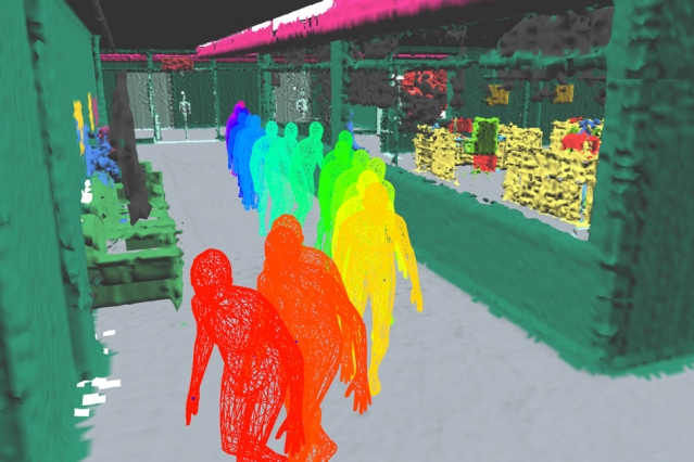 Images: MIT
The new development will be useful not only forordinary everyday tasks where awareness of coordinates is needed, but the technology will also be applicable in production or to explore the place where the disaster occurred.
Read also:
Look at the huge “wall” of hundreds of thousands of galaxies behind the Milky Way
Comet NEOWISE is visible in Russia. Where to see her, where to look and how to take a photo
It turned out that made the Mayan civilization leave their cities