The main changes in the agricultural sector are occurring in the context of digital transformation. This is not just the introduction of new software
Internet of Things (Internet of Things, IoT)
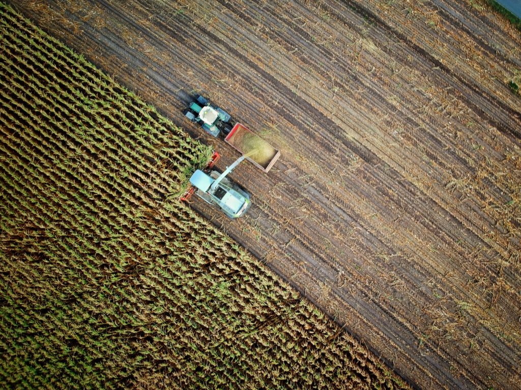
Sensors help in real timemeasure soil characteristics, track precipitation, temperature, humidity, movement of equipment. Due to this, farmers have the opportunity to collect a huge amount of data, aggregate them in an information system, analyze and make more informed decisions. This leads to savings in resources and money, which is important for such a low-margin area as agriculture. Before the Internet of Things, this was not possible.
For example, you can install sensors on equipment andto understand where it is, what route it takes, whether it deviates from it, whether it is idle. Due to this, the agricultural economy optimizes spending on gasoline and prevents theft. Sensors in the soil and weather sensors do not have an effect so quickly, but they help to control the growth of plants, decide when to fertilize, water crops, and treat them with pesticides to get more yield.
Global market for IoT in agricultureestimated at $22 billion in 2021. It will grow by 10% annually, exceeding $35 billion by 2026. But the development of IoT, including in agriculture, is strongly influenced by the quality of communication. Often the lands are remote from cell towers, it is difficult to get a stable flow of information from sensors. The new generation of 5G should make this task easier. But the occupancy of frequencies, the cessation of supplies of imported telecom equipment and the lack of Russian base stations have so far prevented the mass distribution of 5G networks in Russia.
Earth remote sensing
Satellites and drones can monitor andto probe the earth without manual labor. Satellite imagery allows you to assess the situation in the fields at large distances, while drones are more suitable for pinpoint and accurate monitoring. The main advantage of remote methods is a large coverage and the ability to quickly obtain the necessary data. With ground-based sounding, labor costs are much higher, and the whole process takes longer.
Satellite images are available for three mainproviders - the European family of satellites Sentinel, the American program Landsat and Roskosmos. In Russia, Sentinel is mainly used. The resolution of Sentinel-2 images is up to 10 meters per pixel. Drones have a much higher resolution - up to 2 cm per pixel, but each file can weigh several gigabytes, so they are difficult to process. Usually satellites are enough to monitor crops.
 How the drone sees the field
Combining satellite data and information withsensors that are buried in the ground at a depth of several centimeters, it is possible, for example, to compile a temperature profile of the soil. This will save the agronomist from having to manually check with a thermometer whether the temperature in the field has reached the optimum values for sowing. Remote methods also take into account the characteristics of individual sections within the same field.
Geographic Information Systems (GIS)
For agribusiness workers, it is important to visualize information in the form of maps. Today, GIS is the basis and heart of information systems related to the management of an agricultural enterprise.
The agricultural holding creates a layout of a digital terrain,fields and technology. Sometimes they are scattered in several regions and even countries. Information is stored in the information system and displayed in the form of layers. A layer is an attribute of a field, for example, humidity, relief, elevation changes, irrigation and drainage facilities, crops. By switching between different attributes, the farm can form an overall picture of what is happening in the fields.
In the GIS, you can see how the harvest is goingcampaign, in which areas the crop has already been harvested, and where work has not yet begun. Agro-enterprises can see which fields have been treated with pesticides and which have not, whether precipitation has fallen, whether pests have appeared. Or visually track the movement of equipment, evaluate the mileage, the cost of fuel and lubricants, understand the reasons why the norm is exceeded.
 “In GIS you can see how the harvesting campaign is going”
precision farming
Precision farming is a high-precision systemmanagement of an agricultural enterprise, which includes various technologies: the Internet of things, GIS, and remote sensing of the earth. It is based on information received from providers and sensors.
Farming involves dividing the field into plotsbased on their characteristics and, as a result, differentiated sowing, watering, pesticide treatment. If one area of the field usually has a richer crop, you can plant more seeds there. And if the soil in some place is poorer, increase the amount of fertilizer. The ultimate goal is to harvest more crops and save on all stages.
In the classical approaches of agriculture, the fieldprocessed as a whole. Meanwhile, the agrophysical and agrochemical parameters of the soil may differ within the same field, especially when it comes to lands of several thousand hectares. Agricultural operations, taking into account such features, can save 15-20% of resources for the agricultural sector.
Today, many agricultural holdings carry outexperimental work related to precision farming. They usually allocate land for pilot projects and use the NDVI index to break it down into plots. It is calculated from images from satellites and UAVs and makes it possible to learn about the state of crops in different parts of the field.
Artificial intelligence and mathematical modeling
The range of application of AI and mathematical models inagriculture is quite wide. For example, they allow you to predict the amount of harvest during the entire cycle of agricultural work. Thanks to this, farmers can estimate how much money they will earn at the end of the season.
Another popular direction is crop rotation.So called the practice of growing different types of crops on the same land for several growing seasons. Each crop is characterized by its own microorganisms in the root system, the balance of chemical elements that it takes from the ground. So if you plant the same plants in the field for several years, the fertility of the soil will fall every year. It is possible that the land will have to be withdrawn from agricultural use in order to allow it to recover. And if you correctly select the sequence of crops, you can not only even out the balance of trace elements in the soil, but also improve its condition.
An agricultural enterprise can build an optimizationa mathematical model that, taking into account various factors (predecessor crops, crop yields, and so on), gives recommendations for future plantings. Similar mathematical models can also maximize profits. To do this, it is necessary to enrich them with data on pricing and sales.
 “Sensors help to measure soil characteristics in real time, track precipitation, temperature, humidity, vehicle movement”
Prospects and difficulties
Technology development in agriculture is hamperedmany factors: high import dependence of Russian industry in terms of the element base, fragmentation of data and lack of uniform protocols for their transfer, cybersecurity issues (in the case of IoT).
Moreover, the use of technology in agricultureFor the time being, it is mainly large agricultural holdings that can afford to do this on the farm, because the introduction of such tools requires investments not only in the purchase of hardware, but also in training people. Small farms often do little to innovate and still keep information on paper at best. The larger a company becomes, the more pronounced its need to optimize internal processes and increase productivity.
Clean up the information systemimpossible until this order is in business. To make decisions based on information, you must first understand your processes: understand where to get this information, what data is missing, what to do in order to get it, how to overcome the resistance of employees who do not want to share knowledge or are already used to working in certain mode. Therefore, digital transformation occurs from the top down and starts with top management.
Read more:
NASA revealed the origin of Haumea - the most mysterious planet in the solar system
Living organisms have made Mars uninhabitable
The liver can work for more than 100 years: scientists told how this is possible