Work published this month in the journalGeology, complements existing hydrological research
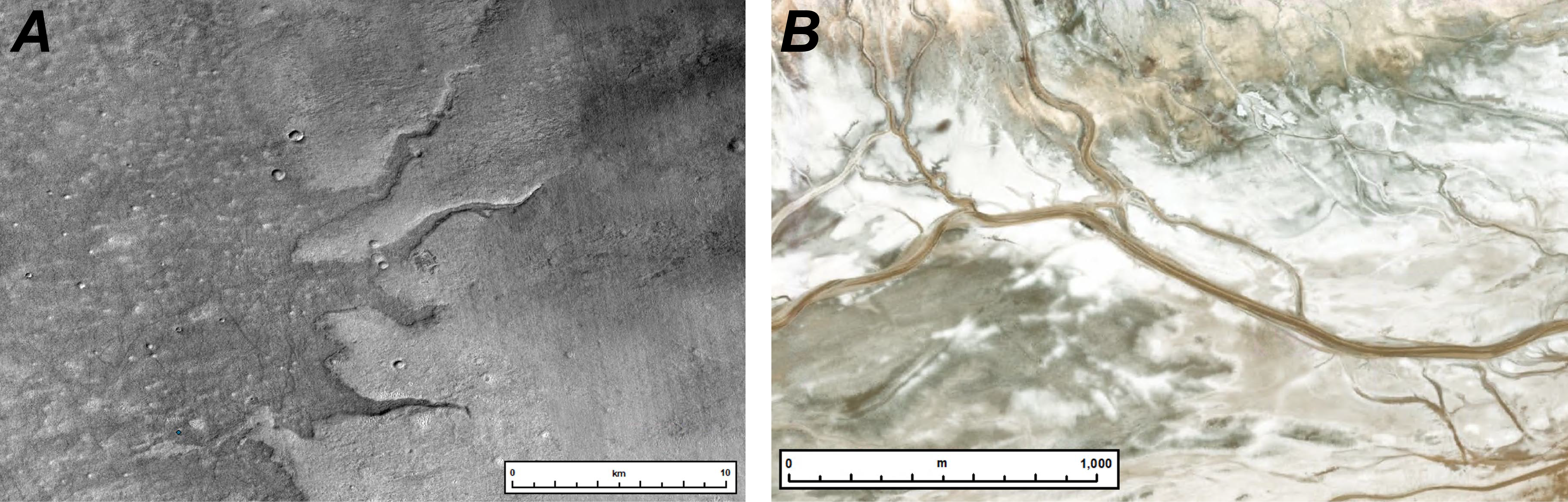 (A) A set of ridges on Mars (-67.64 ° E, 43.37 °S). To determine if objects are ridges or valleys, researchers rely on lighting from impact craters (troughs). The craters show that light is coming from the top of the image. Since the river ridges cast shadows to the south, they can infer that the object protrudes from the surface - a ridge, not a valley. (B) A similar "analog" environment on Earth. River ridges, similar to those on Mars, are found in the Amargosa River system in California, although water still flows through the system and is an active precursor to the ridges that remain on Mars. Credit: J. Dixon
It took almost three years to assembleput together all the constituent parts of the images. This gave scientists an unprecedented view of the ancient river systems that once covered the planet's vast plains. New research is helping to understand the hydrological history of Mars.
All river formations of the southern hemisphere of Marscan only be identified from a high-resolution image of the planet's surface. Each of the 8 trillion pixels represents 5 to 6 square meters. m. Now that scientists have a global understanding of the distribution of ancient rivers on Mars, future research can use this data to explore what past climate and tectonics were like.

Read also
Dangerous climate warming will begin in 7 years
Abortion and science: what will happen to the children who will give birth
Check out the most beautiful pictures of Hubble. What has the telescope seen in 30 years?