The Red River Valley in Minnesota, North Dakota and Manitoba faced one of the worst
False color images were obtainedusing MODIS (Moderate Resolution Imaging Spectroradiometer) instruments on NASA's Terra and Aqua satellites. The first image shows a flooded valley observed by Terra on May 10, 2022.
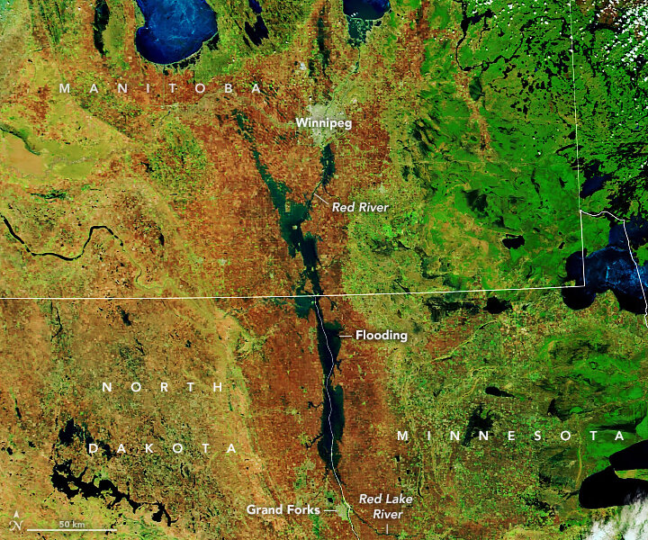 May 10, 2022 Credit: NASA Earth Observatory
The second image was taken by Aqua two years earlier, on May 11, 2020, under more typical spring conditions.
 May 11, 2020 Credit: NASA Earth Observatory
The images combine short-wave infrared and visible light (MODIS 7-2-1 channels) to better distinguish river water from banks.
Flow and topography of the Red River Basinunusual, leading to spring floods. The river flows north from the Dakotas and Minnesota, through Manitoba, towards Hudson Bay. As a result, the upper reaches of the river in the south usually warm up, thaw and flow with spring meltwater and rain, while the riverbeds in the north are still frozen or clogged with ice. This could cause the river to slow down or return to the floodplain.
The river valley is also almost flat and passesthrough a trench formed by continental glaciers about 10,000 years ago. The elevation difference along the river from Fargo, North Dakota to the Canadian border is approximately 40 meters.
Read more
The “fifth force” creates invisible “walls” in the universe. The main thing about the new theory of physicists
You have never seen the Sun so close. Solar Orbiter video published
Compare how the lunar eclipse was filmed by NASA and Roscosmos