Scientists use a variety of satellite and airborne systems to monitor land cover. Target -
This problem is especially acute in the Arctic - therevegetation is more mixed than in other ecosystems. Scientists have recently used aerial UAV systems to monitor changes in vegetation at high resolution. The work was carried out as part of the NGEE (Next Generation Ecosystem Experiment) ecosystem experiment in the Arctic.
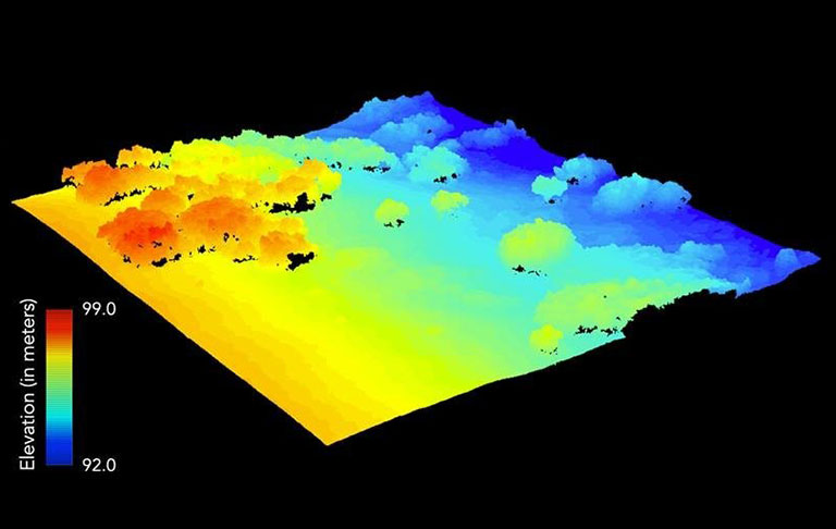 3D visualization of the surface relief and structure of the vegetation cover in the Arctic. Credit: Brookhaven National Laboratory.
UAVs provide vegetation data fromhigh resolution, allowing scientists to better understand how plants respond to their environment. These data are used to predict the impact of climate change on ecosystems.
As the researchers note, UAVs are filleda critical gap in ecosystem monitoring, providing very high resolution observations. They are much easier to deploy in remote areas than other airborne systems and can collect data on demand in a variety of environments. In a study published in Remote Sensing,used a new UAV platform designed to collect detailed information on the structure and functional properties of Arctic plants.
Read more
A huge "black hole" was found in the middle of the Pacific Ocean. The network is wondering what it is
Large reserves of organic matter were again discovered on Mars. Scientists are looking for traces of life
Divers have found the treasures of the legendary "Island of Gold". Artifacts cost millions of dollars