The Amazon rainforest is the largest tropical forest in the world. They occupy
 This image is over part of the rainforestAmazons in Amazon — largest state in Brazil — was processed using the infrared channel of the Sentinel-2 satellite, which makes the dense tropical forest appear bright green. This makes differences in vegetation coverage more obvious than using only the visible satellite channels that our eyes can see. Credit: Contains modified Copernicus Sentinel (2019) data processed by ESA, CC BY-SA 3.0 IGO.
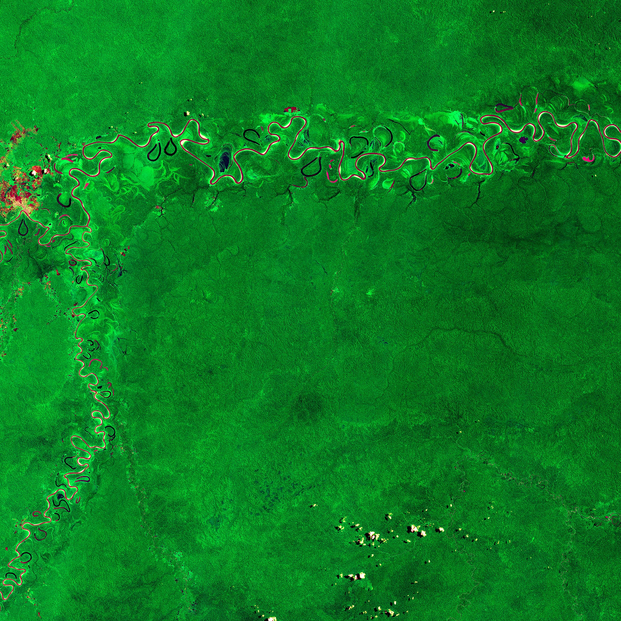
Image processed usinginfrared channel of the satellite Sentinel-2, thanks to which the dense rainforest turns bright green. This allows differences in vegetation coverage to be seen much better than using only visible satellite channels that are visible to the human eye.
Infrared radiation, sometimes calledinfrared light, is electromagnetic radiation with wavelengths longer than visible light. Therefore, it is invisible to the human eye. Infrared light generally refers to wavelengths from the nominal red edge of the visible spectrum of about 700 nanometers (430 THz frequency) to 1 millimeter (300 GHz), although longer infrared waves are often referred to as terahertz radiation.
The Djurua River is visible at the top of the image,the most meandering river in the Amazon. The river has shades of burgundy and purple because the reflected sunlight from the surface of the water consists mainly of blue and green, and the reflection in the near infrared range is almost zero.
The Djurua River, flowing more than 3,000 km toconfluence with the Amazon River, muddy and contains relatively high levels of nutrients. It originates in the highlands of east-central Peru and then winds through the lowlands of Brazil.
On both sides of the river you can see severalcrescent-shaped oxbow lakes and Oxbow Lake. These U-shaped pools typically form when rivers cross a meandering "neck" to shorten their flow, causing the old channel to become blocked - migrating away from the lake and creating a more direct path.
The Amazon rainforest is criticalto regulate global warming, as forests absorb millions of tons of carbon emissions every year. As plants grow, they remove carbon dioxide from the atmosphere and store it as biomass. It is then released back into the atmosphere through processes such as deforestation for agriculture and forest fires.
Read more
Hear NASA's Perseverance rover move across Mars
Physicists have created an analogue of a black hole and confirmed Hawking's theory. Where it leads?
Humans can withstand very low temperatures even without heat sources
Staritsa is a section of the former river bed, which eventually turned into a separate closed-drainage body of water. The old woman, as a rule, has a crescent or loop-shaped shape.