The European Space Agency has published satellite observations of flooding in Pakistan.
While most of the northern hemisphere is experiencingunprecedented drought, the territory of Pakistan is subject to severe flooding. Monsoon rains ten times heavier than usual, which have continued unabated since mid-June, have left more than a third of the country under water.
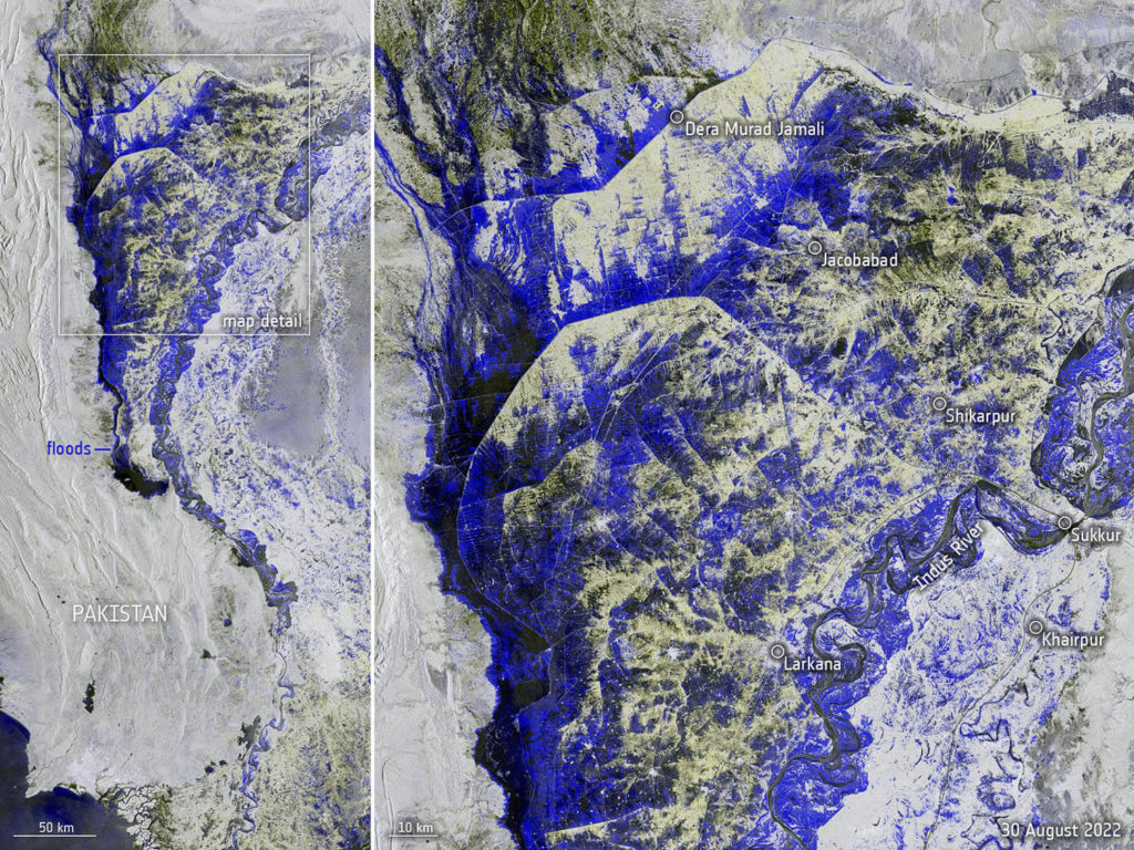 Flood in Pakistan. General view (left) and enlarged image of the most affected area (right). Image:
Copernicus Sentinel data (2022), processed by ESA, CC BY-SA 3.0 IGO
Satellite images show that the Indus River has recededfrom the shores, actually forming a long lake tens of kilometers wide. Various colors from blue to black show where the land is underwater.
Published images taken by the Copernicus missionSentinel-1. This system is designed specifically for monitoring abnormal weather events. The satellite is equipped with a radar device that allows you to "see" through clouds and rain darkness. Thanks to this, he can map what is happening on Earth even during powerful cyclones that block the view.
Prolonged monsoon rains led tothat more than a third of the country's territory was under water. According to the UN, the flood has already claimed the lives of more than a thousand people, and the total number of victims reaches 33 million people. Satellite images are used by rescuers to assess the situation and plan actions.
???? #PakistanFloods update????
WFP assistance to include food relief, malnutrition prevention and livelihoods support.
WFP will also give logistics support for the response. But US$ 34 million is urgently needed to ramp up relief operations.
????Get the full update
— World Food Program (@WFP) August 30, 2022
Read more:
The first images of the underground part of Mars surprised scientists
A galaxy located 12 billion light-years from Earth 'curled up' into an Einstein ring
Plant on Mars produces oxygen at the rate of an average tree