Researchers named the map The Allen Coral Atlas, named after the deceased
The team that created the service stated that it wasthe first high-resolution global map of its kind. It allows users to see detailed information about the reefs, including different types of underwater structures - sand, rocks, seagrass and corals.
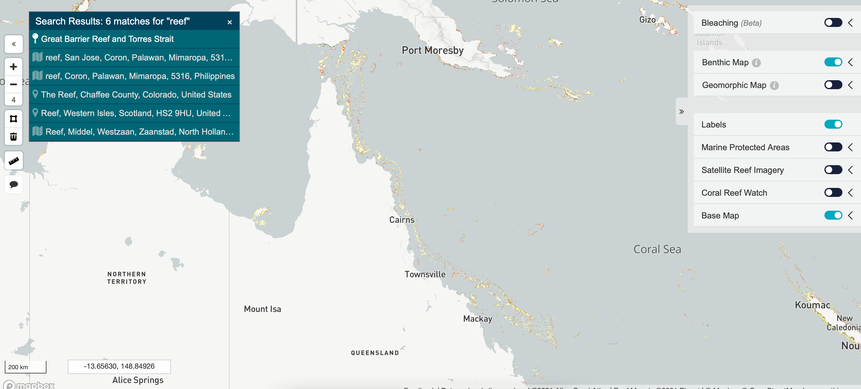
Maps covering areas up to 15 m deep can beused for decision making on marine reserves, spatial infrastructure planning and upcoming coral restoration projects. “Our biggest contribution is that we got a single map of the entire coral reef biome,” said Greg Asner, managing director of the service.
According to Asner, they rely on a network of hundredsfield staff who provide them with information about the reefs so they can program the satellites and software to focus on the desired areas.
Service employees noted that earlier about threequarters of the world's reefs have never been mapped before, especially at depth. It took four years to create this map - the project began in 2017.
To read Further:
New iOS 15: release date, iPhone design and features. We tell everything that is known
An ultra-thin material was made from white graphene. It will replace servers
See a heavy attack drone that carries a ton of weapons