A team of scientists led by Aditya Halleriz of Arizona State University's School of Earth and Space Exploration and
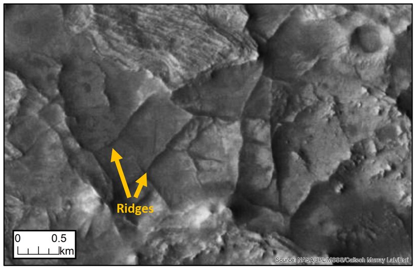 The appearance of the ridges
Their results suggest that mountain ranges on Mars may contain information about ancient underground waters flowing through them.
How the ridge networks on Mars formed remains to be seen.a mystery ever since they were discovered. Scientists have determined that the ridges formed in three stages, first polygonal cracks formed, they filled, and then erosion occurred, which highlighted the networks of ridges.
To learn more about the ridges, the team combined data from the THEMIS Mars Odyssey orbiter and the CTX and HiRISE Mars Reconnaissance orbiter instruments.They then deployed their citizen scientist project on the Zooniverse platform.Nearly 14,000 volunteers from around the world have joined the search for ridges on Mars.They focused their attention on the area around Jezero Crater, where NASA's Perseverance rover landed last February.
Ultimately, with the help of volunteers, the team was able to map 952 ridge networks. So far, this is data from one-fifth of the total surface area of Mars.
The volunteers helped us a lot, because the ridges are basically patterns on the surface.This means that almost anyone with computers and the Internet canhelp identify them.
Aditye Haller, Scientist at the School of Earth Exploration
Read more:
There is another “planet” inside the Earth: how it saved nascent life
Nuclear fusion no longer needs millions of degrees: how the new method works
New study refutes light energy transfer theory